[ Return ] [ Other news articles ]
Reflections on a Motueka River flood
February 20th, 2014
As has been widely reported in recent weeks, Tasman District Council has pretty much decided to scrap the Motueka River stopbanks project, but will talk about their reasons at a public meeting in March.
Some residents who are uncertain of the wisdom of such a decision, or who support it in the belief that there is no serious threat to the town from a stopbank breach, may be interested to read this account and photos of the August 1990 flood, as provided by Shirley Frater:
"Saturday 13 August 1990
"The skies had opened up and it rained. 132mm recorded at Woodstock in a 24 hour period. The water runoff into the Motueka River gathered volume, speed and widened as it reached the flats near the mouth. The flood protection banks were under threat of collapsing. In Riwaka the Riwaka River swelled, flooding the river flats and starting to invade homes.
"A Civil Emergency was declared. Terry Frater was the Transport Coordinator for Civil Defence in Motueka and quickly had drivers, trucks, sand and bags ready.
"A call had gone out over the radio for people to bring shovels and prepare sand bags to be used around the Riwaka homes, and if required for Motueka and the river banks. A lot of people turned up and worked so hard. [Had sore backs after.]
"Shirley organised scones and hot teas for the workers. It was a cold day and somehow tea and scones was a secure comforter for those who were not directly affected by the flooding.
"Several six-wheeler trucks were used to cart the pallets of sand bags to Riwaka. The water appeared only about 60 centimeters below the bottom of the bridge. Large logs and trees were piling up against the piles and the southern side of the bridge.
"There was a mesmerising feeling with the swift water moving in front of the driver's eyes, so concentration was needed to keep to the centre line of the bridge. One truck at a time was allowed to cross. No public traffic.
"The drivers were bloody scared crossing over and back, showing great courage, as the bridge could go at any time. Some men could only do one trip, others quite a few.
One mentioned the bridge swaying in the middle as he crossed. His eyes were dark and spaced out as he sat down, shaking. He had difficulty in holding a cup. Not really wanting to do another trip but knowing the needs of Riwaka.
The rain eased and the water levels dropped but engineers had to check the safety of the bridge. The diggers removed truck loads of trees and debris from around the bridge piles. The flood was the discussion topic for some time."
Shirley told Motueka Online that she would "never forget seeing those drivers and their look of fear and courage".
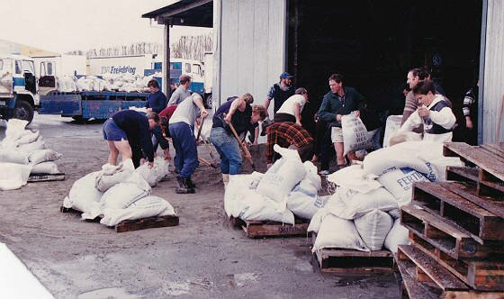
Sandbagging for the 1990 flood
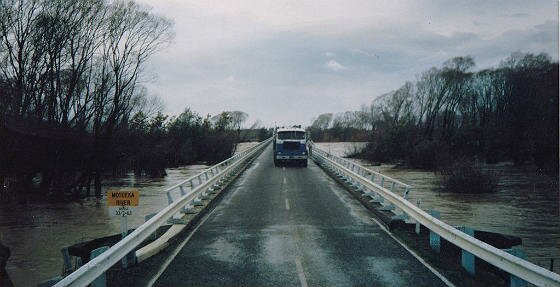
The scary trip across the bridge
|
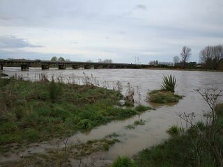
A minor flood three years ago ...
|
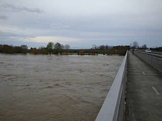
... viewed from the northern end of the bridge
|
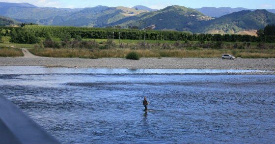
Knee-deep in the full river recently
Comment by Jim Butler:
[Posted 23 February 2014]
The most unfortunate aspect over the Motueka River Stopbanks saga for Tasman District ratepayers is that during the last ten years, at least one million dollars of our money has been spent by TDC staff and their consultants on its planning. Very little, if any of this money, was spent in Motueka. Most was spent in the Richmond / Nelson area.
Yet though the Stopbank upgrade is probably a dead duck now, Motueka Ward ratepayers are still expected to repay most of a $632,000 loan taken out for some investigation work on these stopbanks. With its interest, this will cost us at least a million dollars. I can think of much better uses that all this wasted money could have been put to.
Comment by David Ogilvie:
[Posted 25 February 2014]
Shirley Frater's photos and article are interesting. At that point the Nelson-Marlborough Regional Council had the role and responsibility of the region's rivers. That Council lasted for three years (1989-92) and its functions taken over by the three District Councils - Marlborough, Nelson and Tasman which became "Unitary" authorities.
To my memory the worst flood was in 1983, but 1990 was very similar. In 1983 there was considerable local flooding and I recall water flowing ankle deep from Pah St through the High School, Rugby Park, Swan Hotel (cnr of Whakarewa St) towards the Thorp Drain.
I think by 1990, we had improved the Stormwater drainage in the town! Note, that neither 1983 nor 1990 ranked as a Q50 flood, i.e.a 2% chance annually. The Stopbanks then were to withstand a Q50, but they probably won't in 2014.
>> , to be added to the page. [If this link doesn't work, use this form instead]
[ Return ]
[ Other news articles ]
We wish to thank these local community-minded businesses who generously sponsor our site. They recognise the value of supporting this community asset, and in return Motueka Online is pleased to use and recommend their services whenever appropriate.
Ray White Motueka, Motueka Floral Studio, Nelson Building Society,
House of Travel,