[ Return ]
Looking back at the Baton River
(March 22nd 2014)
Report by Coralie Smith
The noise hit us as we got out of our cars just a few kilometres up the Baton River road - the noise of bird song. The bell birds in particular were very loud and clear. The best start for a day learning about the people and history of the Baton Valley.
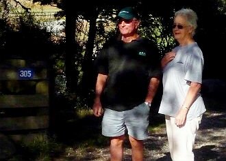
We have known Jim and Mary Lafrentz as town dwellers, involved in many groups and activities. But we didn't know that they lived and farmed in the Baton Valley. Jim was born there and Mary came to work in tobacco from Ngaruawahia and stayed. They farmed the property that had been in Jim's maternal Loveridge family for 3-4 generations.
A sunny day, fresh air, a babbling Baton river and bird song. Starting from the Woodstock end of the valley where the Baton river meets the Motueka and for a short while runs alongside, we stopped to learn about the families who have farmed, and still do, the fertile flats and steep hills.
The Mytton family are at the bottom of the valley. It is their punt that we have a photo of crossing the Motueka River c1900. It was good to learn exactly where it was used. Tobacco and hops were grown on these flats but no sign of that today.
The original Baton bridge piles are still there covered in some creeper but we were able to line up the angles and see how it was orientated with the opposite bank. It was a day of great amusement to the locals the day the army came to blow the piles out and couldn't, they were set so solidly in the river.
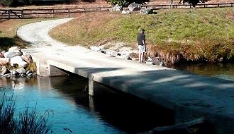
Next the Loveridge/Lafrentz farm which has a nice new, low bridge across the river which wasn't there in Jim and Mary's day. Tales of flash floods and near misses and having to put the vehicles over the river in case of flood seemed far away looking at the clear, babbling river of today.
Sheep and cattle were their mainstay. They grew massive swedes where today pine trees grow. Stories of the telephone going in and party line talk, helping neighbours, lambing problems, stock sales, the airstrip that brought the top dressing plane to the valley - all the stories that make farming in New Zealand such a rich part of our history.
Further up the valley and we come to the start of the Baton Run farm. John Salisbury discovered the spread and ran sheep there. Others followed, using the vast acres that lie beyond the main highways we tear along today not thinking of who was there first.
J.N.W. Newport wrote the books "Footprints" and "Footprints Too" that record much of the Baton and surrounding districts history including how it was originally called Batteyn after a young man called Batteyn Norton but somewhere along the line the spelling has changed.
The road is gravel and dusty today and in places narrow but little traffic and what there is slows down to pass. We pull to the side of the road to see and hear with no trouble.
Then as we approach the top of the valley it opens out into a wide, flat area of many acres. Obviously still farmed although stock numbers low but plenty of baleage in store for the winter. The Lublow family still farm in this area after their forebear Henry Lublow a tailor came from Ashburton in the early 1900s.
The Faulkner and Price family farms were pointed out. Maps were consulted to clarify where we were now. Present day owners named and present day uses of the land also discussed.
More names trip off Jim's tongue as to who is here now and who has gone before. "The Queen of the Baton" Mrs Taylor lived right at the top. She had five daughters who all married men that came as miners - Gilroy, Fowler, Freeman, Guest and McCarthy. Her home has been recreated by someone from overseas who comes every now and then to stay.
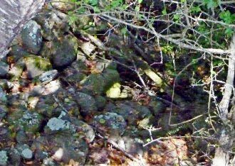
The land is leased out so it is cleaned by stock. Otherwise it would soon revert to manuka and scrub. Near here we fossick along the river to look at the holes left by by the gold miners who lived here in the late 1850s - 1860s. Their sluicing channels are overgrown with manuka but a little bit of exploring soon uncovered them.
Lunch time was spent trying to sort out in our heads where the Skeet and the Ellis and the Clarke rivers all came into the picture. Which were the Twins mountains? What was the name of the hill in the middle of the valley all on its own? It was Sugarloaf.
Which route did the miners take when travelling up from Nelson? Was that the pack trail line still showing on the other side of the river just below the bush line? What schools did the children go to over the years and how did they travel? Were there really a thousand people living here at one time?
A curious story too about Joe Taylor who went off to find gold in Alaska on the Klondike field and never returned. Was his wife Charlotte Eginton who died over there, did he remarry to an Indian woman and was Dave Taylor who Ed Stevens found mentioned in a 1998 newspaper article a descendant?
So many things that only a local can point out and show you as they have lived with it for so many years, know their history and the people in it, they are part of that history. Getting out of our cars and taking the time to listen to them and seeing the places as they talk makes for a good day out. Thank you Jim and Mary.
(We recorded the days outing and the talking. For more detailed information on the Baton Valley contact the Motueka and Districts Historical Association).
|

Jim and Mary Lafrentz at the gate to their former Baton Valley farm
|

Rocks moved by miners in 1860s Baton
|
|

Jim Lafrentz on the new bridge to his former property
|

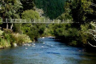
The swing bridge going to the former Lafrentz farm
|
[ Return ]